
Product

Infrared Mapping Drone

Infrared Mapping Drone

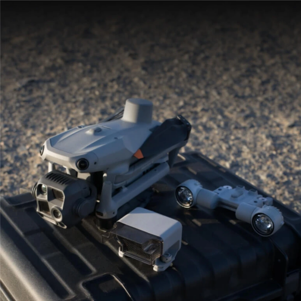
Enterprise industrial drone features thermal imaging, AI detection, 48MP cameras, NIR illumination and 1,800m laser rangefinding for inspections

Wide-Angle Camera:1/1.3″ CMOS, 48MP Effective Pixels, f/1.7, Format Equivalent: 24 mm
Medium Tele Camera:Medium Tele Camera 1/1.3″ CMOS, 48MP Effective Pixels, f/2.8, Format Equivalent: 70 mm
Tele Camera:1/1.5″ CMOS, 48MP Effective Pixels, f/2.8, Format Equivalent: 168 mm
Laser Range Finder:Measurement Range: 1800 m (1 Hz); Oblique Incidence Range (1:5 Oblique Distance): 600 m (1 Hz) Blind Zone: 1 m; Range Accuracy (m): ± (0.2 + 0.0015 × D) [1]
Infrared Thermal Camera:Resolution 640 × 512, f/1.0, Equivalent Focal Length: 53 mm, Uncooled VOx Microbolometer, Supports High-Res Mode
NIR Auxiliary Light:FOV: 6°, Illumination Distance: 100 m
Contact Us To Know More

Intelligent Operations

Smarter Operations

The built-in model can detect vehicles, vessels, and subjects during search and rescue operations or routine flights. It also supports switching to other models, expanding application scenarios. High-resolution grid photos and powerful tracking capabilities make complex missions easier to manage.

Laser Range Finder, Precise Measurement

The laser range finder enables real-time precise measurement. Pinpoint, line-drawing, and area-calculation tools help mark inspection targets or calculate areas such as a wildfire perimeter. Results can be shared with relevant personnel for more efficient collaboration.

Observation Range Recording

The control app highlights the camera frame center and the observed ground area. Surveyed coverage can be displayed on the map, making patrol and rescue missions easier in mountainous terrain without clear landmarks.

Efficient Flight, Intelligent Operations

Activate cruise control to fly in a set direction without continuously holding the control sticks, making long-distance missions easier.

In emergencies, the Drone automatically adjusts its path and speed to the surrounding environment and reaches a designated location with minimal manual input.

Smart Track precisely positions subjects, adjusts zoom automatically, and can reacquire a briefly obscured target.

POI supports continuous observation and three-dimensional modeling while the Drone circles a designated area.

Excel In Low-Light Environments

Night Scene Mode

The Drone receives a major night-mode upgrade with full-color night vision, multiple operating modes, enhanced noise reduction, an infrared cut filter, and auxiliary illumination.

Smart Low-Light Photo

Larger apertures and intelligent low-light processing improve image quality and operating efficiency at dusk and at night.

NIR Auxiliary Light

Near-infrared illumination makes subjects easier to identify in dark environments during protection, patrol, and rescue work.

Thermal Imaging

High-resolution thermal imaging reveals subtle temperature details and provides real-time temperature measurements for demanding missions.

Low-Light Fisheye Omnidirectional Sensing

High-definition low-light fisheye sensors improve positioning, obstacle avoidance, intelligent rerouting, and safe return in dark urban environments.

Crystal Clear Vision: Unveil the Details

Capture Every Detail at A Distance

Enhanced Medium Telephoto

The Drone adds a medium telephoto camera for mid-range inspection work. During power-line or bridge inspections, it can reveal screws, cracks, and instrument readings from a safe distance.

Super Resolution Telephoto

The upgraded telephoto camera captures highly detailed distant subjects, while its infrared cut-filter capability supports dependable round-the-clock operation.

Foreground Stabilization for Telephoto Imagery

Upgraded stabilization keeps foreground subjects steady and clear at high zoom levels, making critical details easier to inspect.

Electronic Dehazing, Clear as Ever

Electronic dehazing offers low, medium, and high settings to improve imaging clarity in smog, mist, and humid conditions.

Accessory Upgrades, Performance Leap

Gimbal-Following Spotlight

The Drone spotlight illuminates distant subjects in always-on or strobe mode. Linked movement keeps the illuminated area aligned with the camera view, while focused and wide beams support different missions.

Real-Time Voice Speaker

A compact voice speaker supports clear live announcements and recorded broadcasts during emergency response, patrol, and site coordination.

Integrated Broadcasting and Lighting

Combined broadcasting and lighting reduce setup time and give operators a coordinated response tool for night missions and public-safety work.

Contact HUIN

Find the ideal production line for your business!

Phone/WhatsApp:

+86 18588993945

Address

West Tower, 16th Floor, Building 2, Yiyun Kechuang Center, Dayuan Street, Guangcong Highway, Baiyun District, Guangzhou, Guangdong, China

Choose File

Accepted file types: jpg, jpeg, png, pdf. Total max. size: 10 MB (up to 3 files).

+86 - 18588993945
Arno Avatar

Sales Manager

Jasper

Online
WhatsApp: QR Code
TOP